Hello, my name is Nigel Coomber and welcome to my web page dedicated to
an eight month round the world trip that I completed in 1996.
The page contains maps, stories and photographs that I took on my journey. Click on the photographs to see enlargements and use the 'Back' button on your browser to get back:
Back to:
HOMEPAGE
PHOTOGRAPHS
TRAVEL LOGS
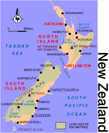
Jan 1996 - New Zealand: (click here to see map)
The first section of my journey was in New Zealand. My flight from Washington DC landed in New Zealand's largest city, Auckland. The first few days were spent hitch hiking down the North Island to the capital, Wellington. A 4 hour ferry crossing took me to the South Island. There are numerous great hikes, known as tracks, all over New Zealand. I completed 5 of these tracks while I was in New Zealand. The first was a 3 day coastal walk along the South Islands North West coast called Able Tasman Track. The photograph above was taken along this track. At the end of the track I swam in the ocean with 4 seals!
I hitch hiked around the South Island in a anti-clockwise direction. A lot of time was spent in the Fjord Lands (east of Queenstown) where I completed 3 more tracks.
After leaving the South Island I completed another track across the inactive volcano, Mount Tongariro, in the center of the North Island (in the rain)! I hitch hiked back to Auckland for my flight to Sidney.
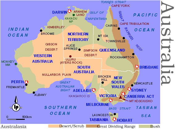
Feb 1996 - Australia: (click here to see map)
A few days was spent taking in the sights of the capital, Sidney, before heading west into the Blue mountains for a week of hiking in the canyons and valleys. Next stop was south at the New South Wales and Victoria border and another week hiking in the Snowy Mountains including a hike up Mount Kosciusko (Australia's highest mountain).
After hitch hiking down to Melbourne I took a flight out to Alice Springs in the Northern Territory and took a 3 day tour out to Ayers Rock (see photograph above). At 3am one morning we climbed up the 1500 feet rock to watch the sun rise.
Another flight east to Brisbane in Queensland completed the Australia section of my journey with 4 days driving around the beaches of Fraser island. Finally I hitch hiked back to Sidney for my flight over to Hong Kong.
March 1996 - Hong Kong: (click here to see map)
I only spent 5 days in Hong Kong staying on the island of Lantau with a friend, Craig. Travel around the main land (Kowloon), Hong Kong island and Lantau was done by the metro system and bicycle. The photograph above shows the business district of Hong Kong at night.
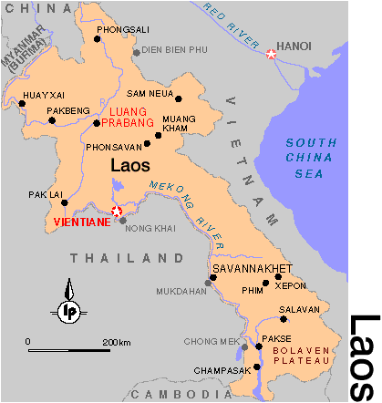
April 1996 - Laos: (click here to see map)
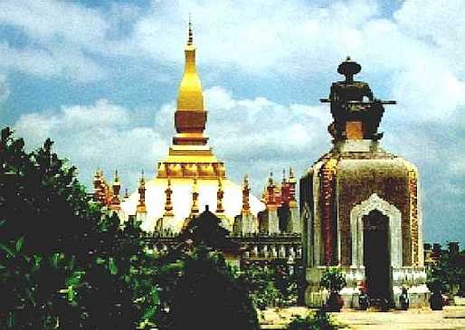
My flight took me to Bangkok, Thailand where I caught the train to Nong Khai situated on the Mekong river. Crossing the river over the recently opened 'friendship' bridge took me to the Laos capital, Vientiane. After a week in the Vientiane area I flew up to the mountain town of Luangprabang, a beautiful peaceful town with temples, mountains and waterfalls which has some how managed to miss out on the 20th century. The photograph above shows Thad Luang in Vientiane.
Back in Vientiane a series of bus journeys took me south to the town of Savannakhet.
Then a very rough bus journey along narrow dirt roads into the mountains through the town of Xepon took me to the Laos / Vietnam border. The US bombed this area very heavily during the Vietnam conflict in the late 60's and 70's. The Ho Chi Minh trail crosses through this area (a route that the VC used to transport supplies and personnel between North and South Vietnam).
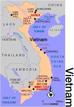
April 1996 - Vietnam: (click here to see map)
I crossed the Vietnamese border at Lao Bao and payed for a bus (full of contraband!) to take me down to the coast and the infamous highway 1 at a town called Dong Ha. A few days was spent in the old DMZ (De-Militarized Zone) and in the tunnels of Vinh Moc.
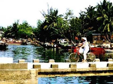
Just about every mode of transportation imaginable took me south along highway 1, stopping at Ho Ann, Hue, Nha Thran, Dalat and eventually Saigon (Ho Chi Minh City). The photograph above was taken at Ho Ann.
April 1996 - Cambodia: (click here to see map)
A short flight from Saigon took me to Cambodia's capital city, Phnom Penh. Much of Phnom Penh still bears the scars of the deadly Khmer Rouge regime from '75 to '78. Many of the schools and Universities were destroyed and have not yet been rebuilt. I spent a day a few miles out of the city in one of the infamous 'killing fields'. These camps were used to kill millions of people during the Khmer Rouge reign.
Another short flight north to the town of Siam Reap allowed me to spend a few days in the Angkor Wat temples. The temples were built in the 9th through 11th century by successive kings during the Angkor empire. The empire ended abruptly and the jungle reclaimed the area until it was rediscovered late last century. Photograph to the above shows the Angkor Wat.
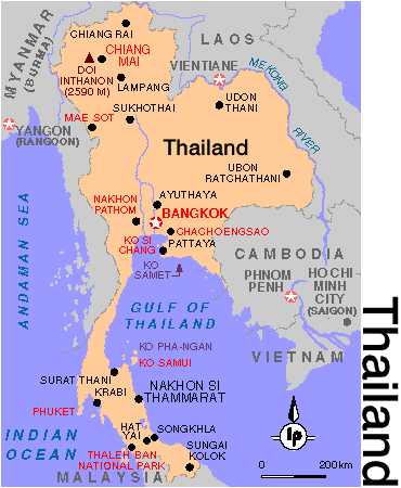
May 1996 - Thailand: (click here to see map)
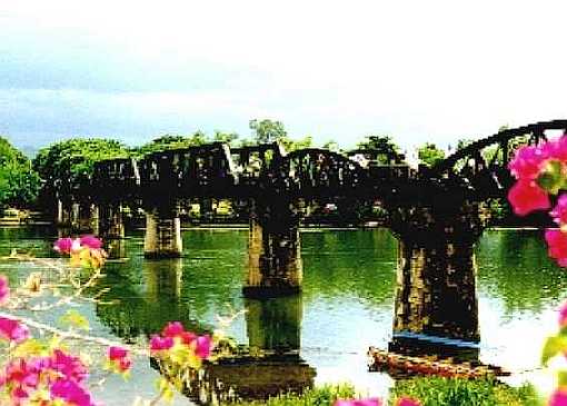
After flying back to Bangkok another over night train journey and a couple of days on buses took me to the town of Mae Hong Son in North West Thailand near the border with Burma. I teamed up with a girl from Denmark, Ina, and we spent a few days trekking through the mountains and jungle before heading south to Kanchanaburi on the river Kwai. We stayed a few days near the famous 'bridge over the river Kwai' as shown in the photograph above. We then traveled down the 'pan handle' of Thailand and took a series of ferries to a couple of islands in the gulf of Thailand, Ko Toa and Ko Samui.
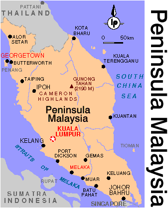
May 1996 - Malaysia and Singapore: (click here to see map)
I took a flight from Bangkok to Malaysia's capital, Kuala Lumpur, known simply as 'KL' and then traveled south through Melaka to Singapore. A series of ferries took me to the island of Sumatra in Indonesia before returning back to Malaysia.
The photograph above was taken in a highland national park north west of KL.
May 1996 - Indonesia (Sumutra): (click here to see map)
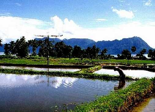
I Arrived in Pekanbaru by ferry from Singapore through the eastern delta regions of Sumatra. Another 'rough' bus journey on a very hot day took me to Bukittinggi where I spent a few days touring the area by scooter. The photograph above was taken near Bukittinggi. Traveling north through Sumatra I arrived at Lake Toba where I spent a few days on an island in the middle of the lake. I then headed to Medan, the capital of Sumatra, before catching a flight back across to KL.
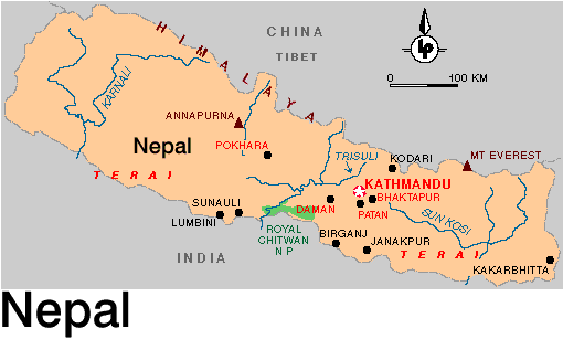
May / June 1996 - Nepal: (click here to see map)
Prior to landing in Kathmandu, Nepal's capital city, we were afforded a beautiful view of Mount Everest to our west. I would not be seeing the mountain again as the trek I undertook was around the mighty Annapurna mountains a couple of hundred miles east of Everest.
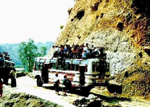
The journey to the start of the Annapurna Circuit trek was rough. An 8 hour bus journey from Dumre along narrow dirt roads sat on the roof with 50 other Nepalese was enough to put you off public transport for the rest of your life. The top is apparently the safest spot on the bus! At least you can jump off as the bus tumbles down the mountain side!
For five weeks I walked around the Annapurna mountains (approx 26000 feet) teaming up with other travelers along the way, eating and sleeping with locals in the mountain villages. Each day we climbed higher. At an altitude of 14000 feet and 8 days walk lies the village of Manang. We had a rest day to allow our bodies to acclimate to the height. The photograph to the above shows the monastery in Manang with Annapurna II towering behind. I joined up with a German guy, Karlu, and we took a 3 day detour from the Annapurna circuit up to a 16000 feet high lake along a less popular route. Yaks were sighted along the trek and the altitude was starting to take effect (we were careful to make sure that we slept lower). After rejoining the main circuit trek we teamed together with Matt (Oz) and Eric (Canada) and attempted to walk over the Thorung pass (almost 18000 feet). Our first attempt failed due to snow and 'white out' conditions. We returned to the base camp and successfully crossed the Thorung pass the following day.
The first village after the pass was Muktinath with its natural springs and temples. We then descended for the next few days staying a couple of days in Kacbeni at the entrance to the Mustang valley. The photograph to the above was taken from Kacbeni.
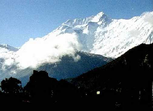
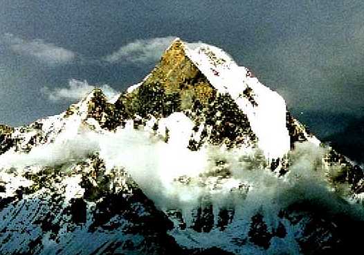
Heading down the valley to the village of Jomsom we then headed back into the mountains to join the Annapurna Sanctuary trek. Climbing again we reached the Sanctuary at 16000 feet. Surrounding the sanctuary are 360 degrees of high Himalayan mountains, Annapurna North, Annapurna IV and the most impressive, as shown in the photograph above, Machhupuchre (Fishtail).
Finally the trek was finished when I walked into the town of Pokhara. A few days was spent relaxing in the bars and restaurants before the bus journey back to Kathmandu and my flight to London (via New Delhi).
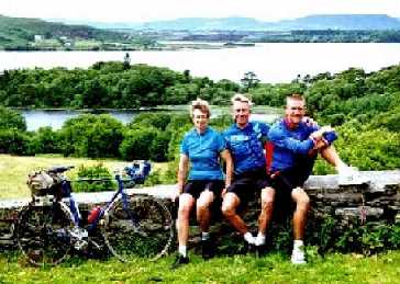
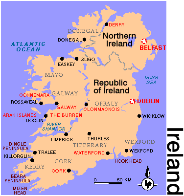
July 1996 - Ireland: (click here to see map)
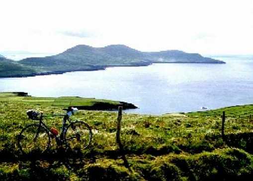
My flight from Kathmandu took me to London (via a day in New Dheli) where I met my parents and the three of us flew across to Dublin, Ireland, complete with bicycles each. We spent the next three weeks cycling around the peninsulas of Irelands South West.
We caught the train from Dublin to Cork and then followed the coast around the Beara, Kerry and Dingle peninsulas staying at Youth Hostels along the way. The pace was easy and frequent stops were made at the many country pubs along the way for re-fueling (Guinness!). We calculated that we cycled about 15 miles to the pint!
After flying back to England I spent a couple of weeks in Leeds and did some cycling around the Yorkshire Dales before flying back to Washington DC.
|


